11 Miles
After a delightful evening looking at the stars emerge in the sky from the warmth of the wood fired hot tub at Chy Kel, we’re up early and walking down to Trevauance Cove, ready for a long walk.
A low grey blanket is hanging over the tarnished blue seas, rippled white at the edges where the sea meets the stark grey cliffs and the sandy beaches. We find the steps out of Trevaunance Cove and look back at the typical Cornish cove. Intriguing to see a tin mine being converted to a home on the edge of the town.


On the top of the cliff, gorse is flowering around the grey spoil hills. On this stretch of the walk to Perranporth we see just one walker. The path is wide and very stony through a patchwork of heather and gorse, not the most picturesque of landscapes, but maybe when the heather is in flower? A steep rocky path, the smooth bits smeared by the drizzle, into Trevellas Coombe is extremely tricky to navigate. At the bottom an iron gate has a sign saying The Motor Cycling Club, founded 1901?


A bridge takes us over the stream and we follow the rocky pathway up the other side through Blue Hills Tin Streams countryside. The rocks here are a brilliant red colour, unlike any I’ve sign before. At the top of the hill the countryside is flat flat flat, perfect for an airfield – Perranporth Airfield.


A bright orange windsock signifies it is still used as an airfield but I can see a little white car driving around. I’m curious, and my curiosity is satisfied when I discover that you can learn to drive here – a network of private roads has been set up, complete with road signs, junctions and roundabouts for anyone over 14 wanting to learn to drive – superb!

The wide gravelly paths continue through the dark ground cover, even starker today against the grey clouds, feeling almost moon like. You can almost sense an imminent slide of rocks towards the sea, taking the web like structures, covering mine shafts, floating out to sea. The rocky cliffs are broken up shard-like sticking out of the sea in all angles. The whole area, devoid of people, is very dramatic but feels quite eerie.


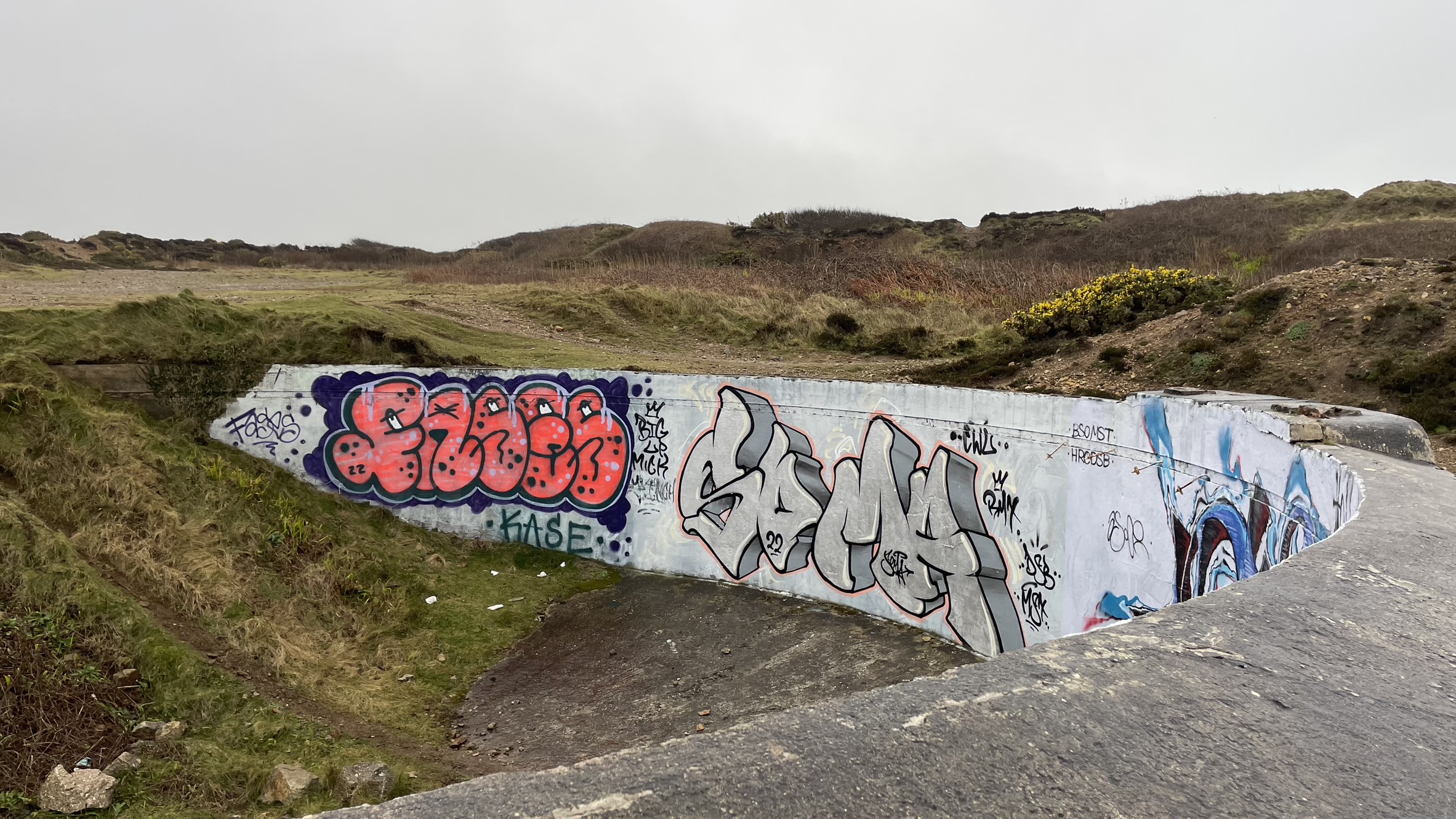
As we continue through an area scarred by tin mine works the exposed rock is almost white, lines of embedded flint running snake-like through it. Looking back at the images it really does look like we were transported to the moon! We stumble across stark concrete buildings graffitied by a talented artist with a taste for smurf like creatures with big smiles and long noses!


A sign on the side of a large round concrete structure informs us that this area is known as Cligga, and has been mined for 2000 years. This area has a chequered history of tin and wolfram extraction and during World War 1 local women manufactured hand grenades and shells!


We get a little lost at this point, but work our way across the stark landscape to the coast path which finally arrives on a road that winds into the tourist resort of Perranporth – civilisation at last.


A large sun dial on the cliff top, made of granite blocks and a steel pointer is no help with telling the time in this weather, but our stomachs are telling us it’s time to eat. The aptly named Alcatraz café perched on a cliff in the bay is the answer. The sourdough toasties are oozing with melted cheese and the hot chocolate is piping hot. The view of the bay is ever-changing with the sun starting to peep underneath the clouds in the distance. We are watching the sea retreating round the cliff that sticks into the bay. The map shows the coast path on the beach but the tide is against us.

There are a few too many dog walkers with yapping dogs on this beach for my liking so it’s a relief to be walking over the cliff top to Perran Sands. We take a chance that the tide will allow us to climb out of the bay at the other end of the sands and walk down the incongruous, yet functional concrete formed cascade to the beach.


After a short while we are the only ones on this massive stretch of sandy beach. I remove my walking boots and wander along the water’s edge. It’s COLD. The sky is now a brilliant blue dotted with white puffy clouds. A full forty minutes of walking along the sand then I’m trying to rub the sticky stuff off my feet to don my boots and walk up the cliff.

Just over the rocks we discover a delightful little freshwater pond hugging the cliffs and reaching underneath into a cave, blocked by a metal gate. We linger for a while taking photos then head up and over the cliff onto Ligger Point. It’s a delightful spot up here overlooking Perran Bay with Dartmoor ponies grazing on the cliff top. But as we round Hobyn’s Cove the landscape is dominated by what looks like a disused military camp.

I’m very distracted reading about the tragic story this camp has to tell of soldiers surviving Dunkirk to be hit by a Luftwaffe bomb whilst recuperating at Penhale Camp in the Cornish sunshine on a Sunday afternoon.
Now disused, with military style wire surrounding the camp replaced by post and wire fencing. I’ve looked up the developers who have a sign on the ground to reveal a very interesting “unique holiday hideaway” company who have a site very close to my home that I now want to visit! I’m very intrigued to see how they develop this site – will they retain the Nissen huts, built by American servicemen during the war and the various military dwellings?


The going round the next headland is very easy going through grassland passed more military enclosures, one warning of non-ionizing radiation, whatever that is? The waves are rolling in to Holywell Bay, although there are no surfers there are families dotted over the wide expanse of sand. We follow the coast path right into the edge of the village around a large pub with beer garden, passed the disused shop and out onto The Kelseys, another beautiful National Trust owned headland with stunning views back to the bay. The climb out is tough, very tough on steep sandy dunes, every step slipping back down before the next one.

We stop on the hilltop for a well-earned break, the sound of Nigel snoring heard over the sea breaking on the cliffs below! Sheep are grazing on the grassy hilltop below the blue skies, so different from the moon like landscape of the beginning of todays walk.
I spot a seal bobbing in the seas as wander inland to Porth Joke. We move closer to the cliff top to get the binoculars out and watch the seal only to discover a tiny sandy cove with several more seals playing on the beach. As each wave comes in another seal, both big and small is washed in, the ones on the beach rolling over each other or just lazing on the warm sands. Wonderful. We stop for a while to enjoy a peep into their little world.
The path weaves into Porth Joke and over a little stone bridge. There is a handful of people enjoying the beach, one brave guy takes a 30 second dip into the sea, I have a feeling I know why…


Our last headland of the day is Pentire Point West. The last ones, with the end in sight are always the longest and it turns out we have no access to the beach and have to walk right around the back of Crantock beach through The Rushy Green to Crantock Beach car park.


We’ve made the decision to stop our walk here as it is tricky crossing The Gannel. There is a ferry in the summer time, a tidal bridge further up the stream adding an extra four miles to the walk. So, we end on the beach overlooking the houses on the Pentire Headland with their long gardens reaching down to the estuary.
Leave A Comment