8 Miles
After a cosy evening in our holiday cottage in Lelant, spent mostly trying to dry yesterday’s clothes, we are up early and heading to Zennor by soon after 9 o clock. We’ve been joined by Heather, Mark and Lola the cockerpoo for our holiday.
Pop the pound coin in the honesty box at Zennor car park and make our way behind the Tinner’s Arms to the coast path.

The weather forecast is dry until two this afternoon so we are hoping to complete this often talked about coastal walk to St. Ives in around four hours. The OS Map says 3 hours 41 mins but I know the going is going to be tough.


I’m surprised I didn’t spot yesterday but a large area of gorse has been severely scorched. The charred relics of gorse stand lonely over the jet-black scorched hillside, with occasional re-growth of ground cover plants. I wonder if the gorse will re-grow or whether theirs a seedbank of gorse seeds waiting for light? The gorse fires were started by lightning back in July this year, when we were last in Cornwall. 2022 certainly was a scorching dry summer.
It’s a relief when the charred remains transform to bronzed bracken and the stench of fire remains behind us. We pose for photos on Zennor Head then wander along the muddy track between the grass, stumbling over the occasional rocky outcrop.


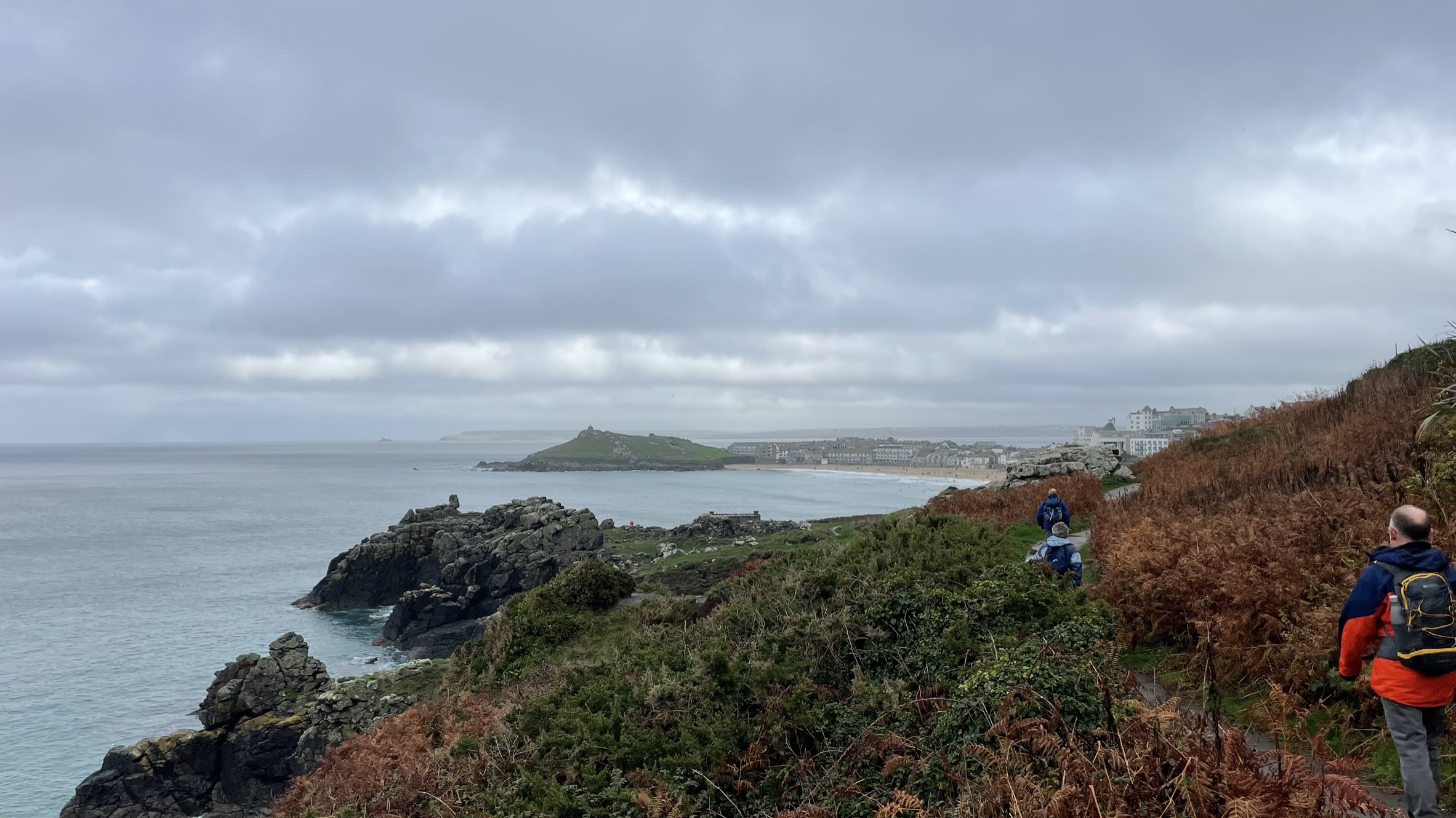
The path weaves around the granite outcrops, up Tremedda Cliff then almost down to the water’s edge. The massive granite rocks on the beach have just the gentlest of waves slipping over them. I think I see lots of small birds on the rocks furthest out, but with the aid of binoculars realise it is in fact seaweed. It’s a proper scramble over the next rocks towards Wicca Pool then over a little bridge.
The walk continues in a similar manner around Mussel Point and Treveal Cliff. Our eyes flitting from checking the next spot to place our foot between mud and rocks and out to sea where the waves are crashing over The Carracks.
There is more gorse in flower today, and almost no trees at all, just the occasional low blackthorn hedge. In fact, we have seen next to no trees for a couple of days in the countryside – I’m guessing this area must be subjected to some severe winter weather.


On a very exposed spot on Trevega Cliff stands an Ordnance Survey triangulation pillar – the little blue triangle on the OS map. Theirs is little else man made on this stretch of countryside. A tiny boat goes passed; a fellow walker tells us it is most likely taking tourists from St. Ives to look for seals. We don’t see any seals today.
The terrain becomes more easy-going for a while until we come to a split in the pathway. The lower path towards the sea being the coast path, is fairly treacherous on the muddy descent. A passer-by is looking for five Dartmoor ponies. As we round the corner, we find them enjoying a grassy feast. We carefully pass them then just round the corner meet a lady, also volunteering for the National Trust and looking for them. I wonder how often they come out to check?


At precisely five passed two the BBC weather forecast is proved right when a rain shower stops us in our tracks to put on our raincoats. Looking along the coast we can make out the Godrevy Island lighthouse, which is beyond St. Ives, so we must be getting close. Some kind workers have created a fabulous rock pathway through the waving grass at the end of which we can now see Porthmeor Beach and The Island, with the stretch of Carbis Bay Sands in the distance. It’s always a little incongruous to see urban areas when you’ve been out in countryside all day.


The rock-strewn muddy paths make way for a tarmac path lined with the occasional park benches. The path winds through the bracken for a while until arriving in the outskirts of St. Ives, round the bowling green which had seen better days onto the road above Porthmeor Beach. Despite the time of year, which to be fair is unseasonably warm, there are surfers surfing. All of them in wet suits. Surfers are loading there gear on to campers, or changing into new gear at the surf shop.


We wander down to the beach, enjoying the feel of the sand underfoot and dodging the occasional wave. The RNLI have a full set up with marker flags, a large truck and a 4 x 4 with a rescue boat on its trailer.

At the far side of the beach, we take the path up, then round The Island and back into the town. If I’m honest I find the town too busy, cars driving right along the cobbled front, holiday makers in bars and eating ice creams along the quay edge. Our search for the perfect cream tea café with tables outside, warm scones and clotted cream is unfruitful so we opt for an ice cream on the quay edge.


Five then go on the GWR branch line to Lelant via St. Erth. Lola, the cockerpoo, isn’t sure about getting on the noisy train, but we soon settle down and enjoy the magnificent view of Carbis Bay. That’s a teaser for tomorrows walk, but for now it’s time for supper at our holiday cottage, oh and we need to collect the car from Zennor.
Leave A Comment