4 Miles
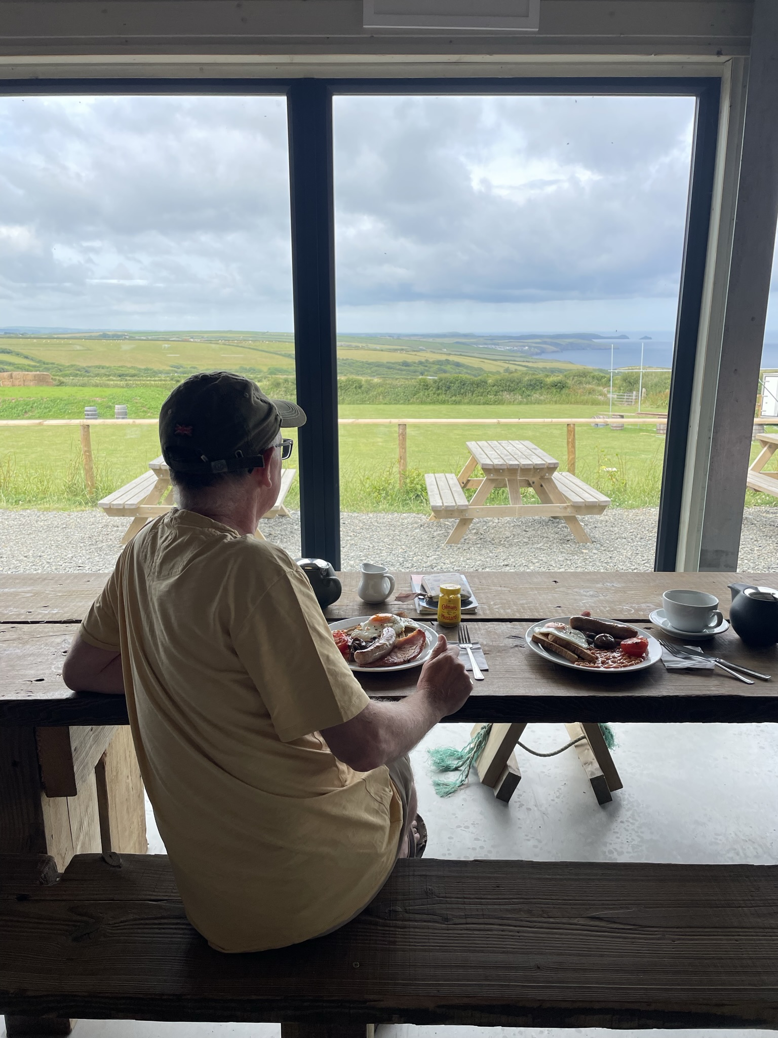
After yesterday’s epic walk in the sunshine, we don’t set an alarm. Our slow start is bookmarked at the beginning of the day with a superb breakfast at The Sea View Farm Shop, just up the road from Rosebud Farm camping. It’s a tasty “Full English”, made even better by the fabulous view of the countryside and distance coast.
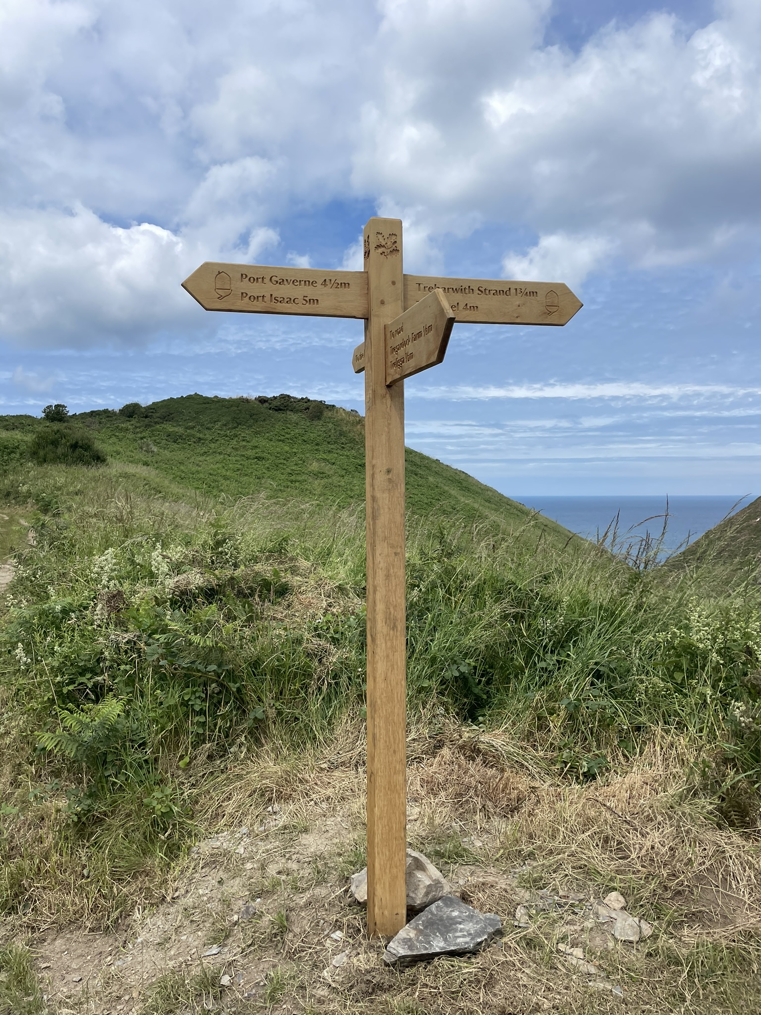
Having discussed our walk up from the coast path with our friendly campsite owner we opt to take a different route today. Walking further along the lane towards Treligga, cutting down to Tregonnick Pont. We did miss a short bit of the path but hey-ho! A brand-new wooden sign says Trebarwith Strand 1 ¾ m and Tintagel a mere 4 miles.
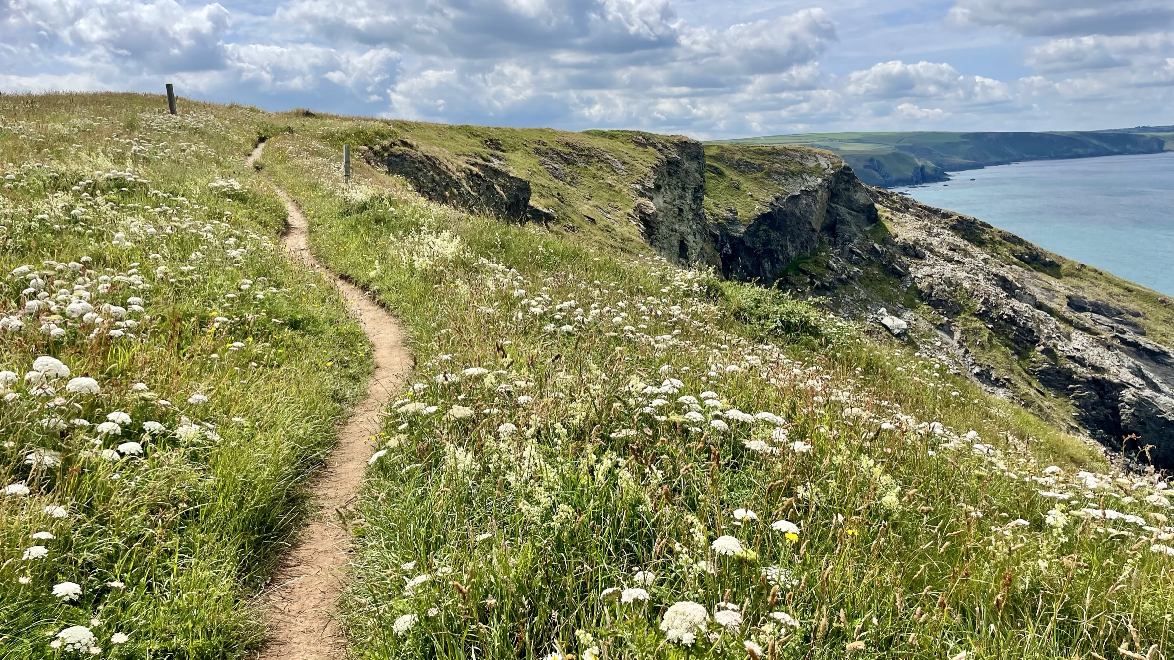
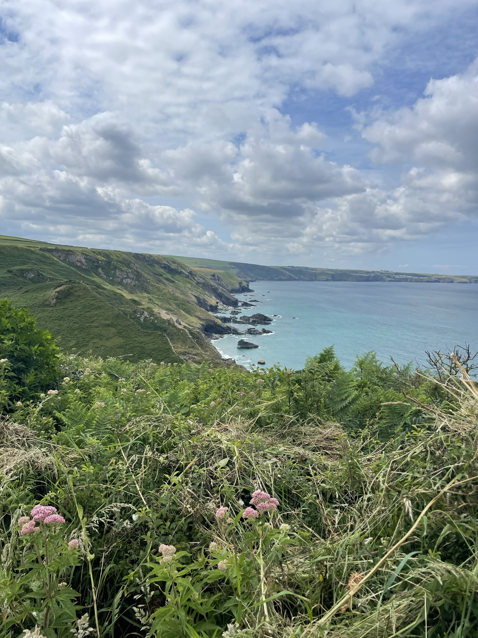
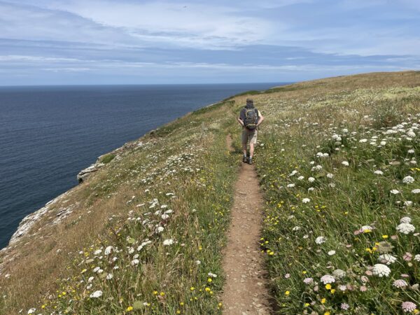
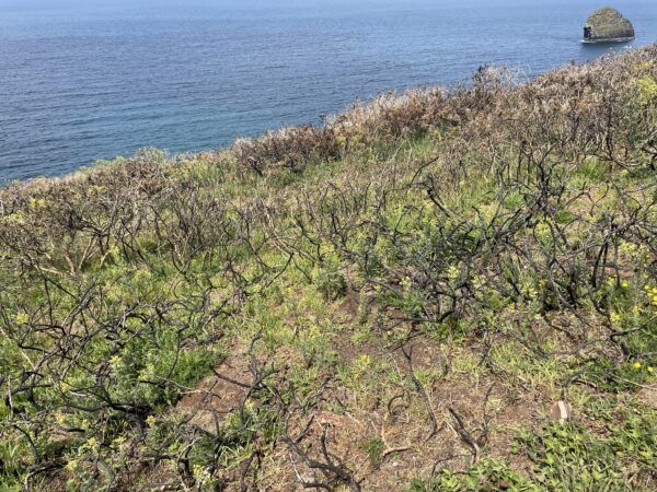
There’s slightly more cloud cover today, but the sky is still blue, the sea still calm, and the rolling hills still green green green. Looking back, we can see beyond Port Isaac and Port Quin to Rumps Point, this side of the Camel estuary. A single-track path weaves through long grass, bracken, hemp agrimony (Eupatorium cannabium) and low-rise gorse bushes. Further on Wild carrot (Daucus carota) and yellow Hawkweed are abundant. These meadows above Treligga Cliffs, owned by the National Trust, couldn’t be prettier. A small area of gorse has been transformed to blackened branches by a wild fire, but the grass and gorse are starting to recover.
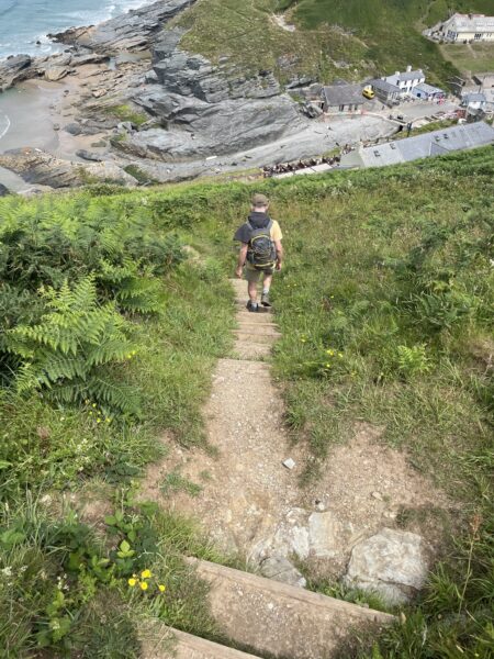
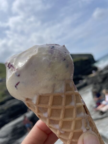
It’s a steep climb down to Backways Cove, and back up the other side. We are rewarded with the view looking down onto the buildings straddling the road at Trebarwith Strand, including what looks like a pub with a beer garden. The steps down are very steep, the homes and shops at the bottom brightly painted and bustling with holiday makers. We opt for an ice cream rather than the pub, after all, the “Full English” was only a few hours ago.
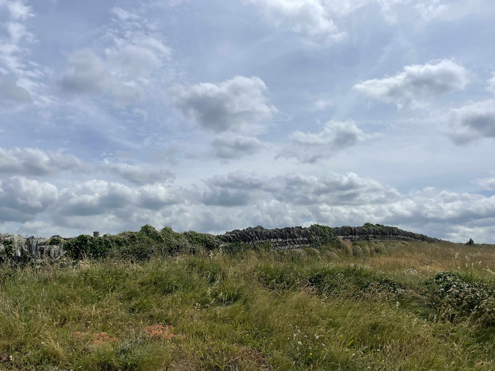
A National Trust board tells of the slate quarries along this stretch of coast to Tintagel, now transformed into a haven for wildlife. The names on the map portray its history – Long Grass Quarry, Lambshouse Quarry, Gull Point Quarry and many more. These slate quarries have given rise to a beautiful coastline, barren of trees, due to the salt leaden gales and beautifully compartmentalised by the dry-stone walls, which since reading this board will be referred to as “beautifully constructed herringbone, or “curzyway” stone hedge borders.
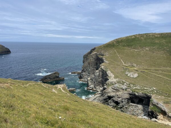
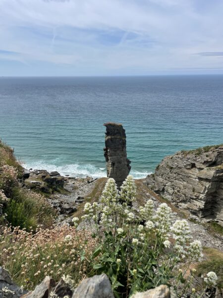
It takes little over an hour to walk this stunning stretch to Tintagel, mostly single track through the grass, over the curzyway walls, above the stunning rocky cliffs. We stop to take a picture of a narrow stack, grass still growing on the top, and the pennywort growing out of a wall at Bagalow. There are few signs of its industrial past.
As we near Tintagel we start to share the path with other walkers and can see a church perched above the waving grass, we pass the Tintagel Youth Hostel. The Tintagel bridge comes into view, spanning the rocks. Before we left home, we watched a programme on how they built it – constructed in 2019, it’s to cantilevered structure, just a few centimetres apart in the middle.
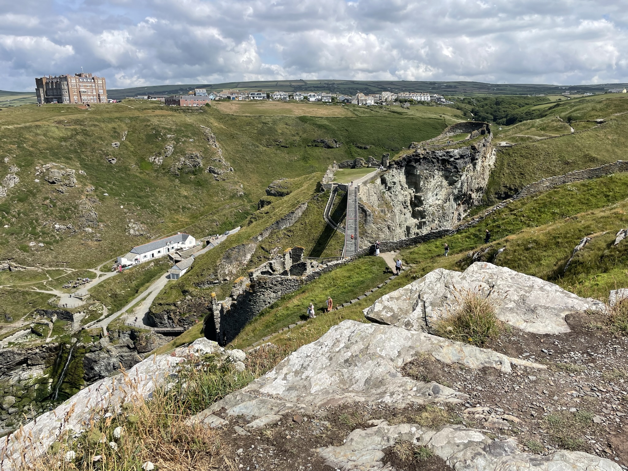
We stop for sandwiches overlooking the castle, foolishly feeding the birds, then pay the entrance fee and venture to the castle.
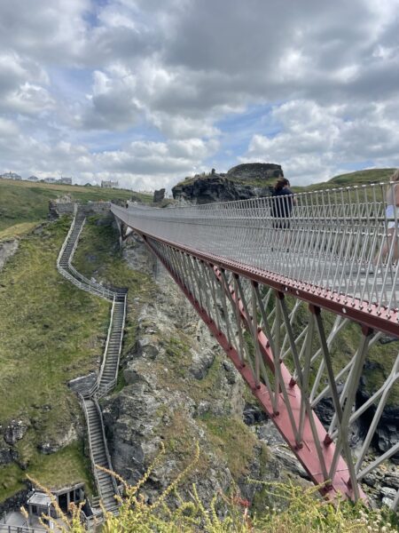

The bridge is by far the highlight, I stop to take a picture of the middle section, while Nigel dashes over. Then walk around the remains of castle with a history going back to the Romans and the legend of King Arthur. For many, I guess, the highlight is the stunning views and the chance to see the beautiful coastline from this amazing viewpoint?
On the next cliff towards Boscastle is the brick built, rather imposing, Camelot Castle Hotel, the cream tea and evening meals come highly recommended by our campsite owners. Maybe we will stay there on our next visit? We leave Tintagel castle via the beach and the steep walk up to the town where we enjoy a drink in a pub then catch a taxi back to our campsite.
Leave A Comment