10.5 Miles
Wake up at the Coverack Headland holiday apartment and decide to head from here rather than driving to our destination and taxi-ing back. But first we walk back to the village shop to where we left off yesterday to buy Danish pastries for breakfast. I’ve grabbed my Nordic walking poles as I have a feeling it’s going to be a tough one.
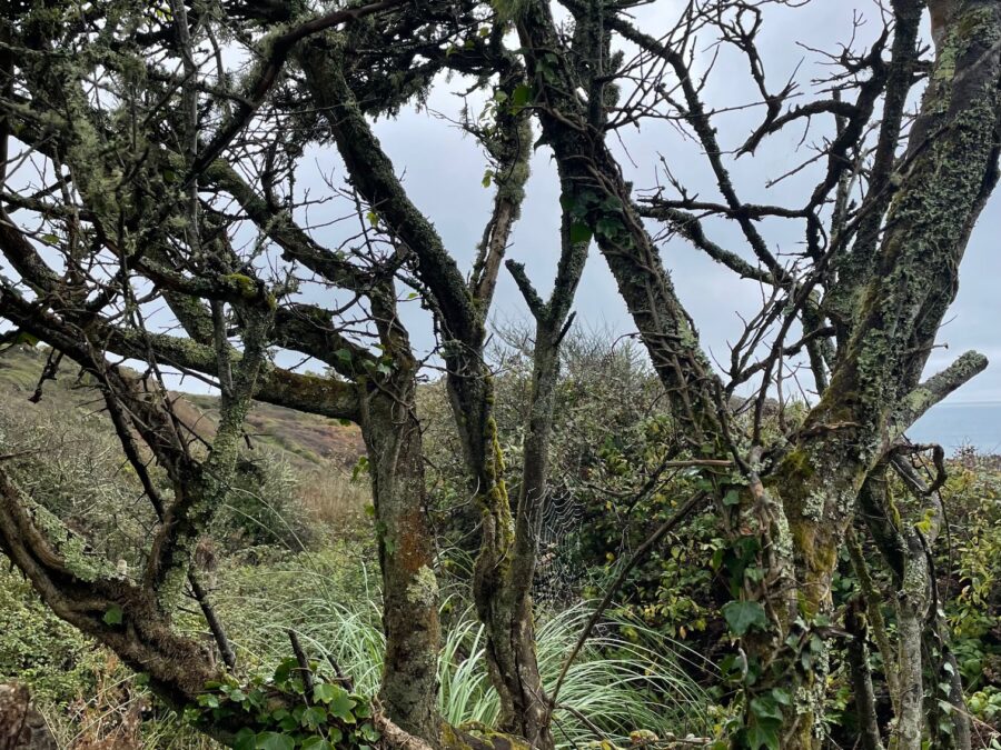
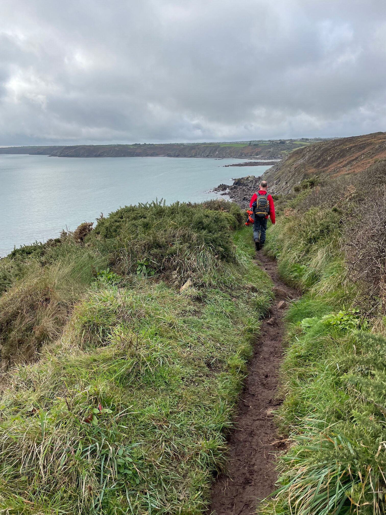
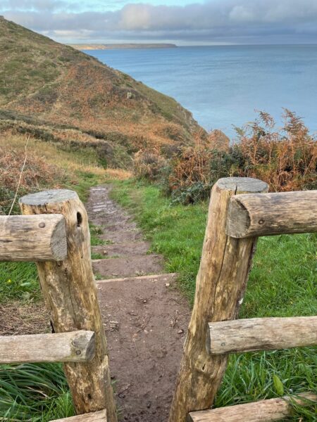
The coastal path is well signposted from Coverack Headland and we are straight out into open countryside, admiring the cobwebs in the bare trees and soon looking back at the large apartment block on the headland.
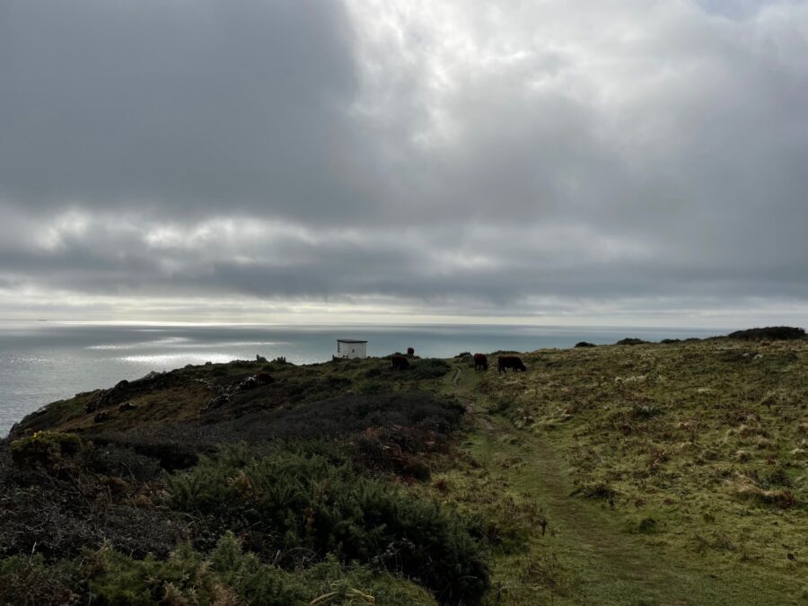
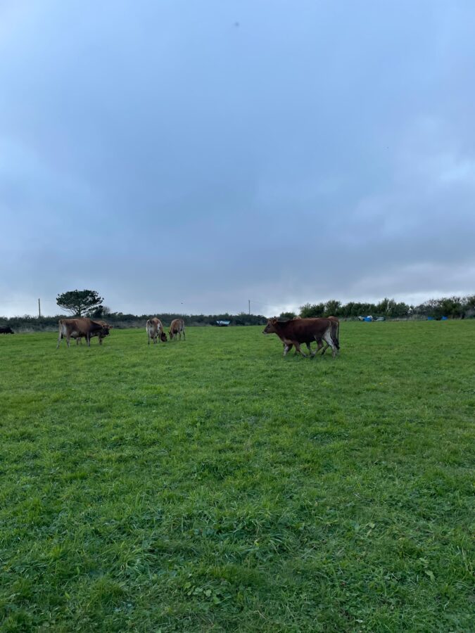
On a walk with very little punctuation our first dot is the old coastguard lookout above Black Head; cows are grazing around it, birds are flying above us and the sun is trying very hard to peek out of the low cloud cover. Thankfully the early morning mist has now cleared.
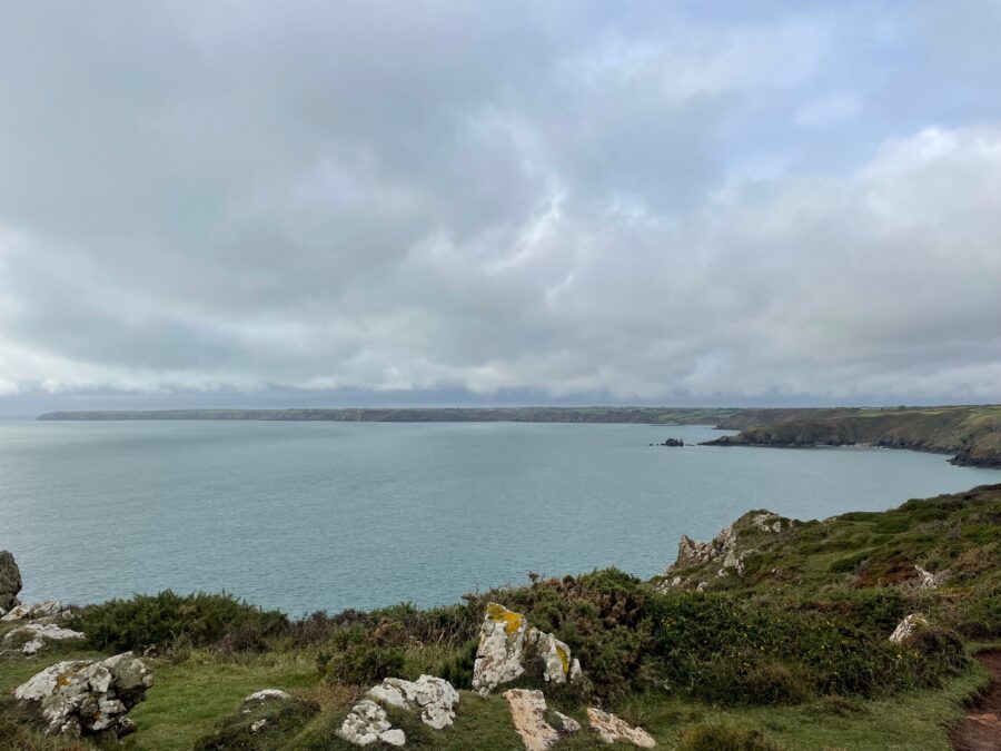
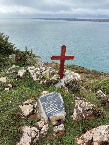
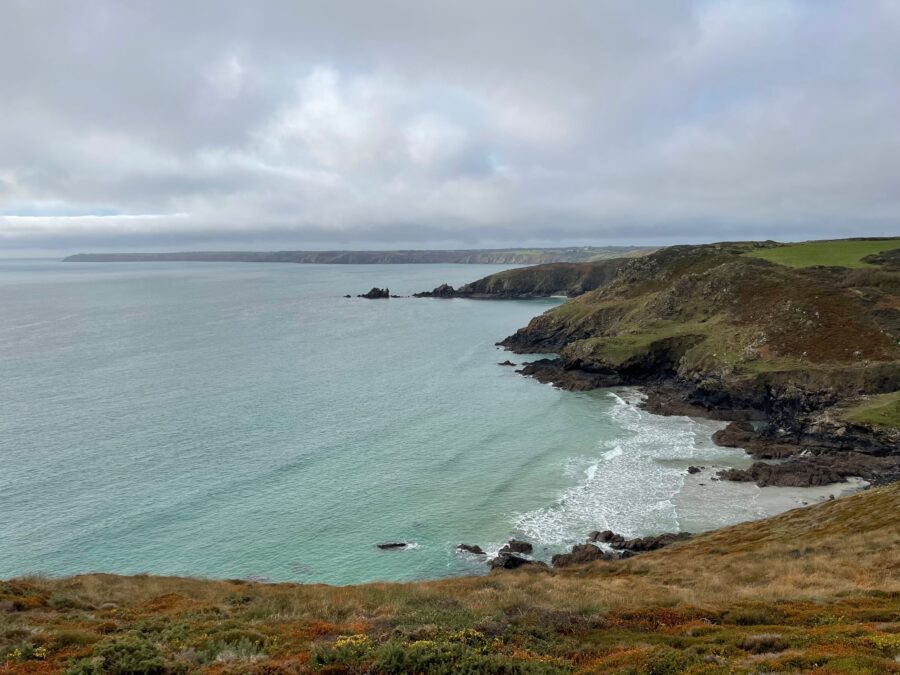
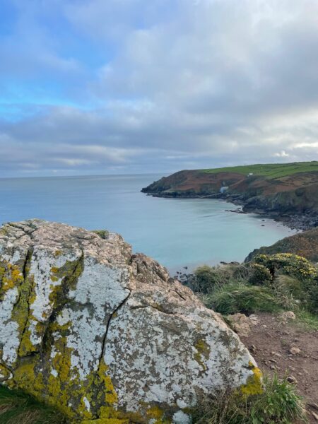
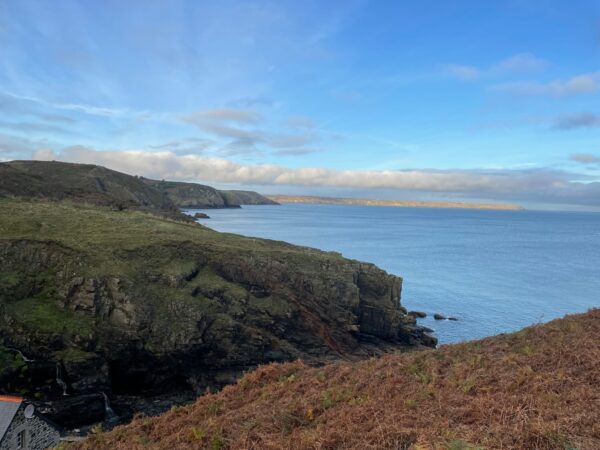
Looking ahead we can see round the whole bay towards the Lizard Point – very few, if any trees and a very level cliff top all the way round. At Beagles Point we come across the memorial spot for the Royal Navy helicopter, Sea King XV702, which crashed into these cliffs on the night of 21st March, 1974. The cross and memorial plaque are quite recently positioned –memorial services are held here to remember the lives of the four young men who lost their lives.
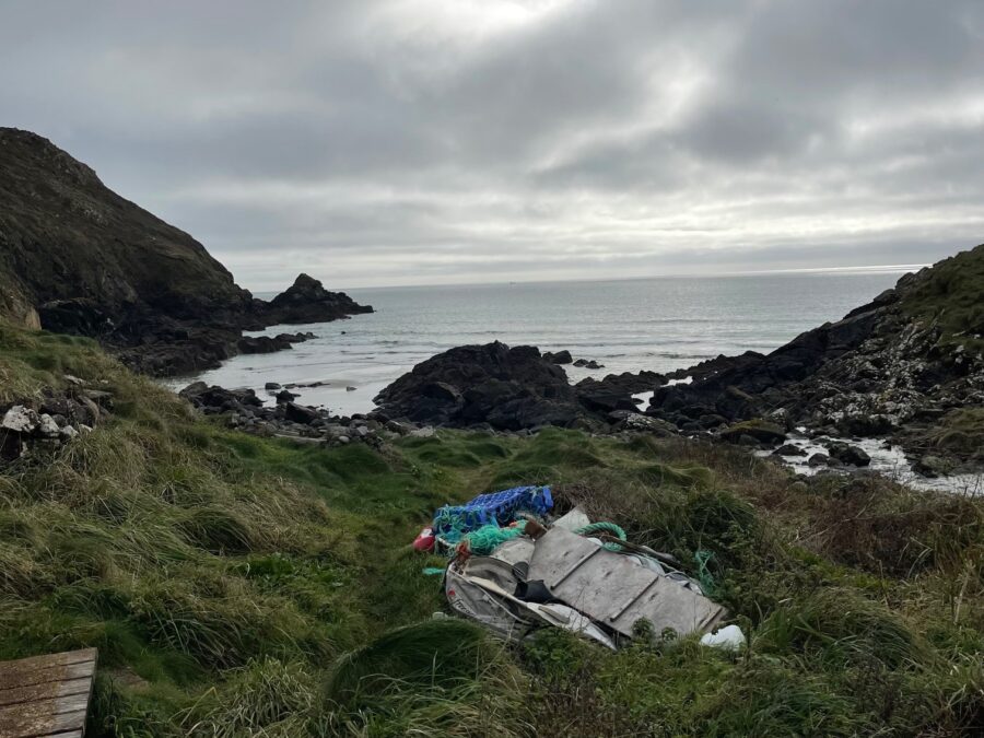
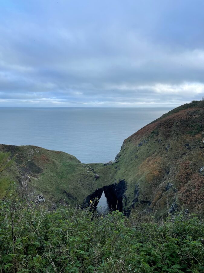
We cross a sturdy wooden bridge then follow the path as it weaves down to sea level at Lankidden Cove, where the remains of a boat and fishing gear rest in the grass, hopefully to be collected before they wash out to sea.
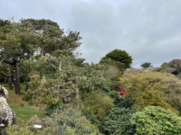
Another wooden bridge and we head back up to cliff level, looking down over the next sandy cove. Not far on it’s a nice surprise to be walking the perimeter fence of a garden bursting with interesting trees and shrubs. Tall Monterey pines, a couple of windswept cypress trees, rhododendrons and a chimney poking above in the distance.
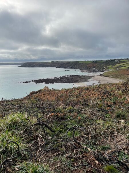
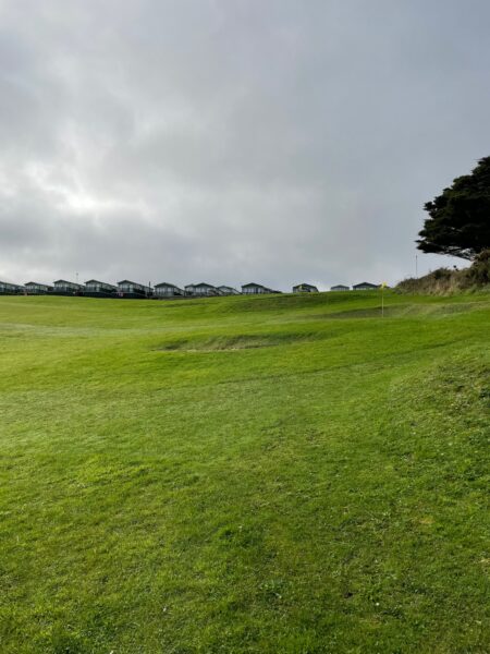
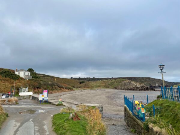
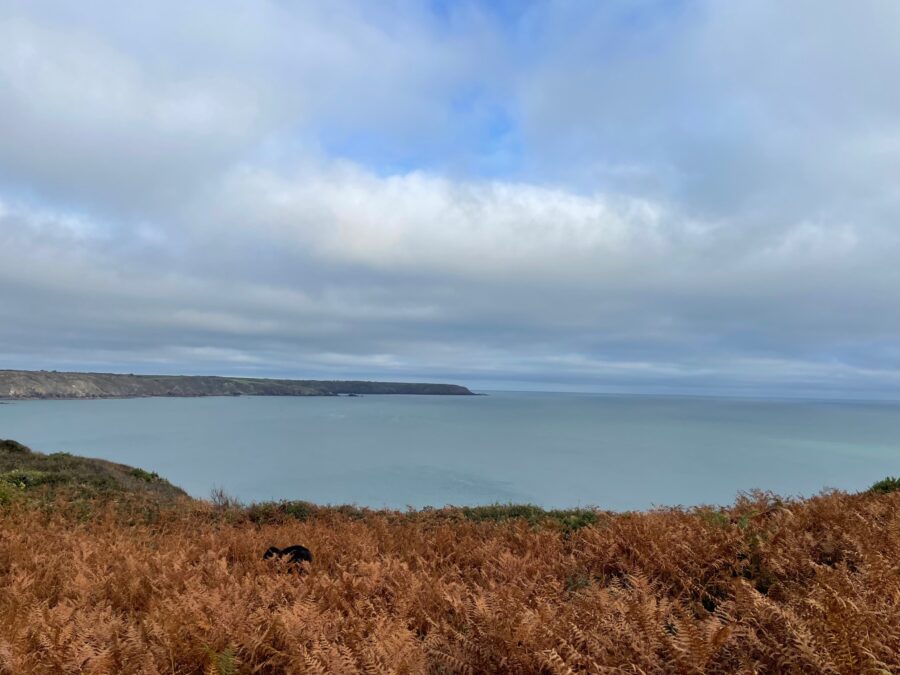
The gorse between us and the clifftop has been badly scorched by a wildfire at some point, but we can see over to a the lovely sandy Kennack Sands Beach with a holiday park on the fields beyond. As we near, we can see that there is more to offer than meets the eye on the map – car park, toilets and beach café (closed for the season), and apparently big surfing waves. But today we’re the only ones around, the sea is right out and the waves are just a ripple.
We continue along the muddy path clinging to the edge of the cliff, the bronze of the faded bracken contrasting against the grass and low-lying trees and shrubs of Thorny Cliff.
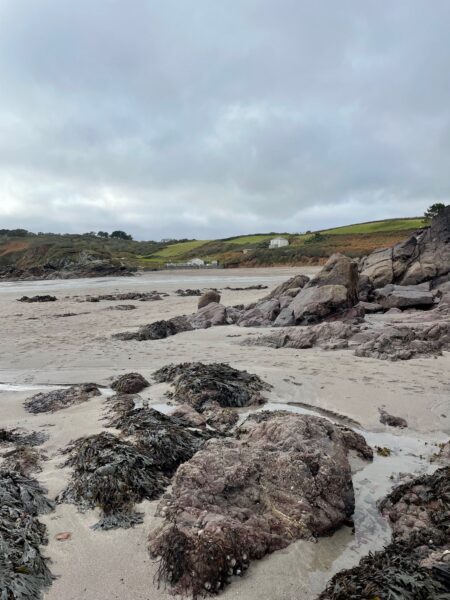
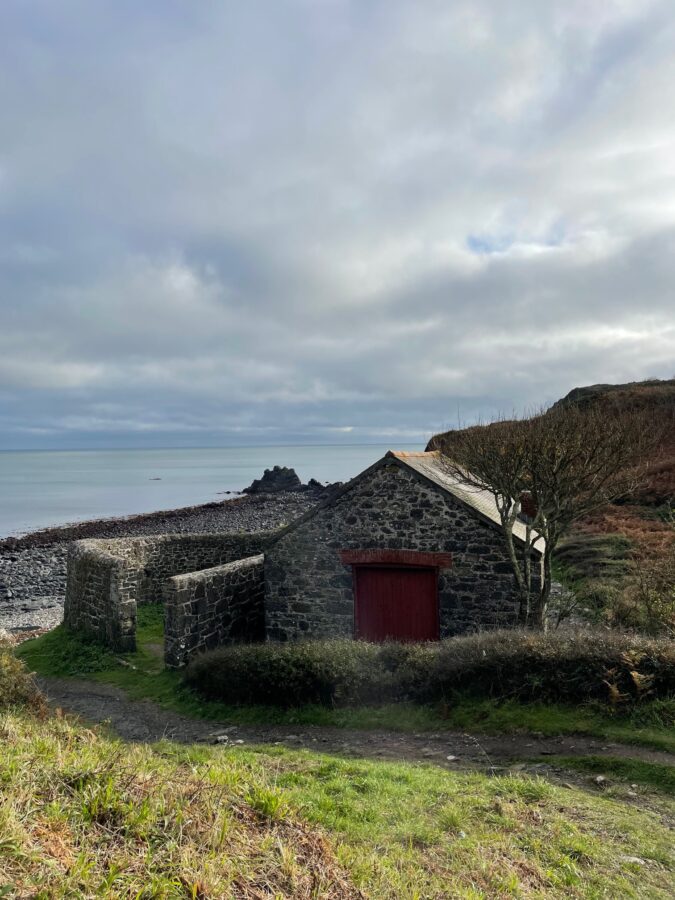
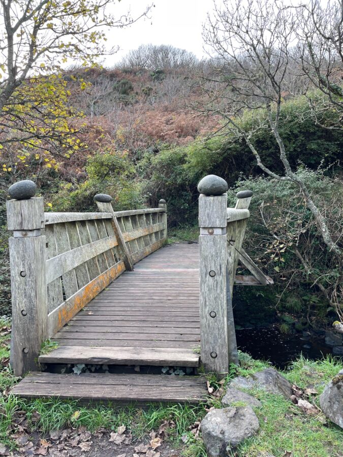
There’s a group of people on the rocky beach at Poletesco, a very smart stone building then an even smarter wooden bridge – love the grey pebble finials. Below us water is gushing through on its final leg to the sea.
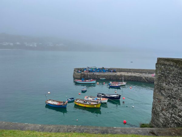
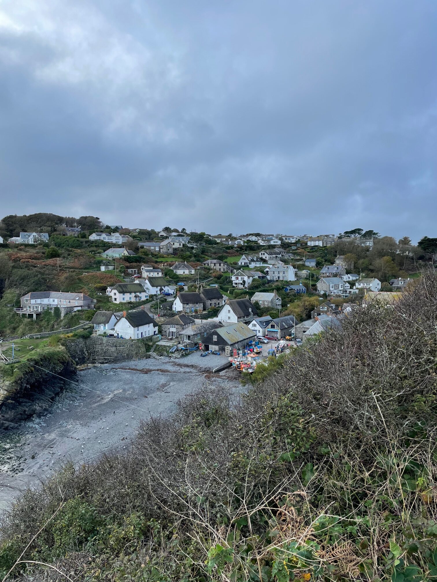
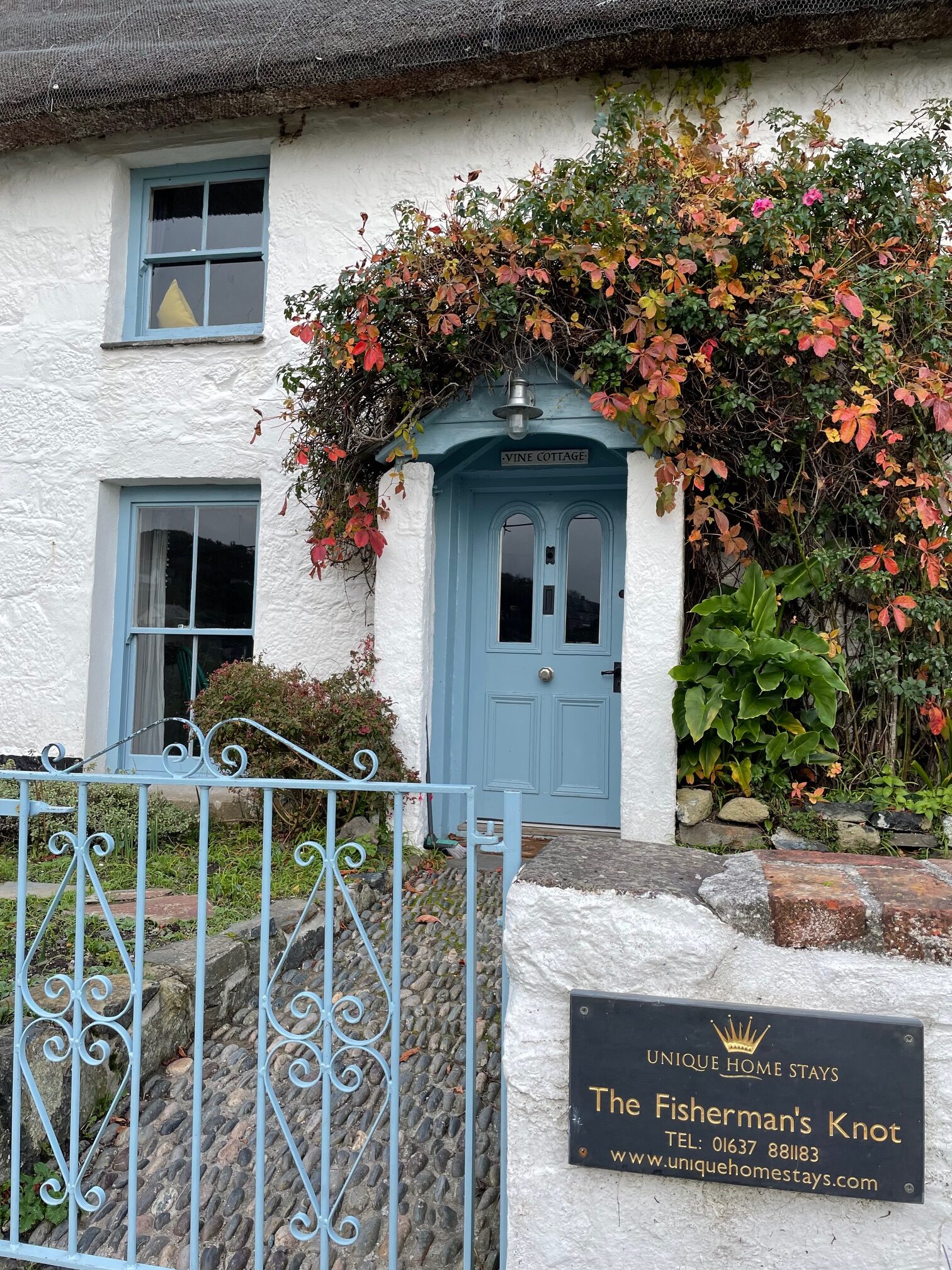
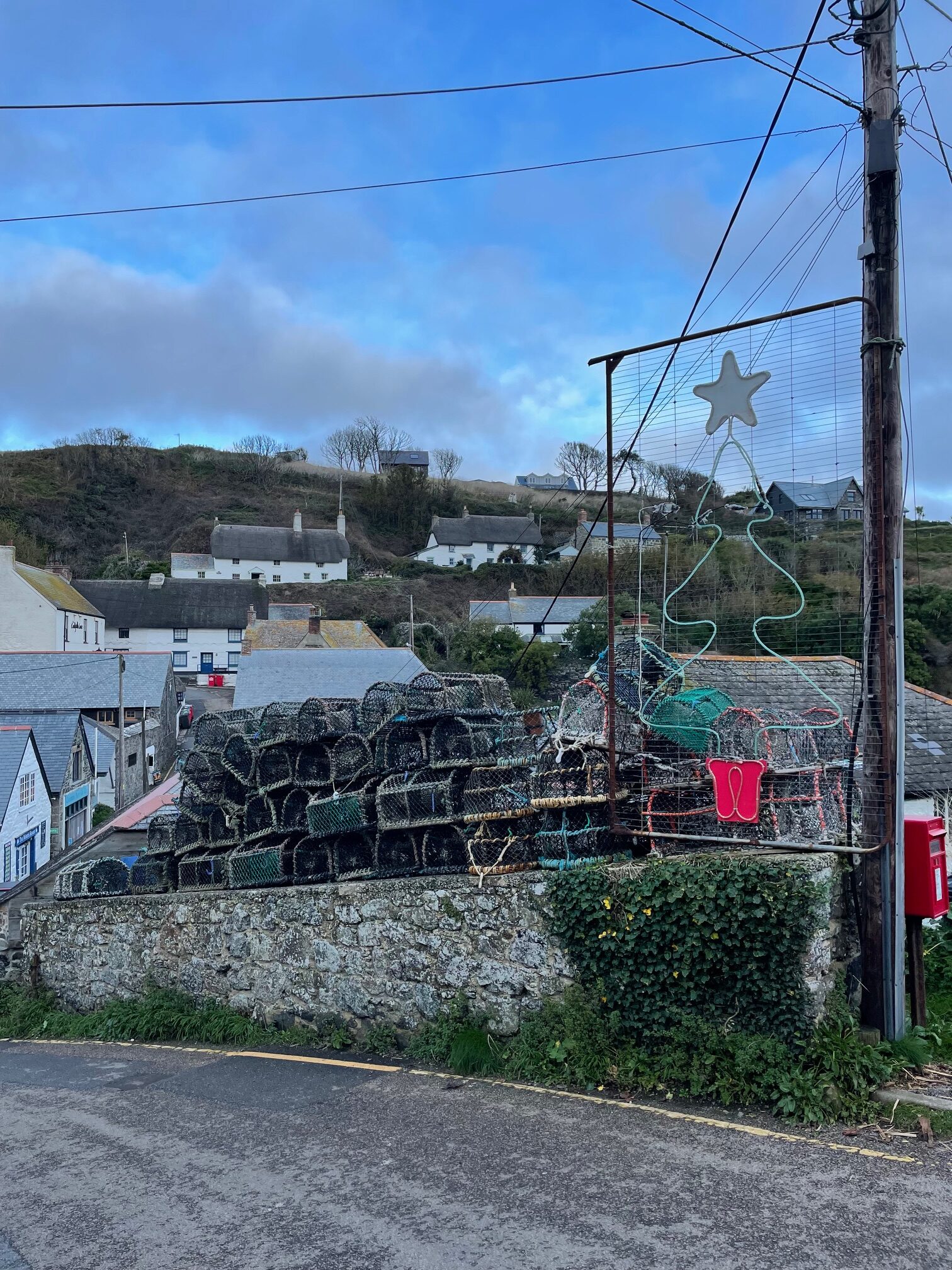
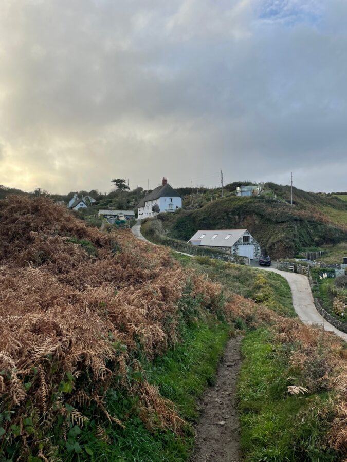
What’s that hiding in the gorgeous bronzed bracken? I think a pony… the path continues round the next headland, again, very close to the cliff edge then descends into a quaint fishing village. The gorgeous little valley of Cadgwith and, on the cliff above, Ruan Minor is dotted with whitewashed cottages, many with thatched roofs and a quintessential pair of chimneys either end. There are fishing boats pulled up out of the sea, a smattering of shops and lobster pots piled high.
What’s that hiding in the gorgeous bronzed bracken? I think a pony! The path continues round the next headland, again, very close to the cliff edge then descends into a quaint fishing village. Cadgwith and, on the cliff above, Ruan Minor is a gorgeous little valley dotted with whitewashed cottages, many with thatched roofs and a quintessential pair of chimneys either end. There are fishing boats pulled up out of the sea, a smattering of shops and lobster pots piled high.
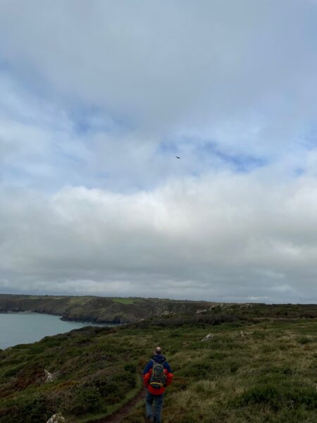
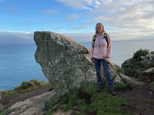
We continue straight through, keen to get to the close of today’s walk before the sun goes down. Although I pose for a photo at the Devils Frying Pan, say hi to the cows as we pass and Nigel stops to see how far he can throw a stone into the sea.
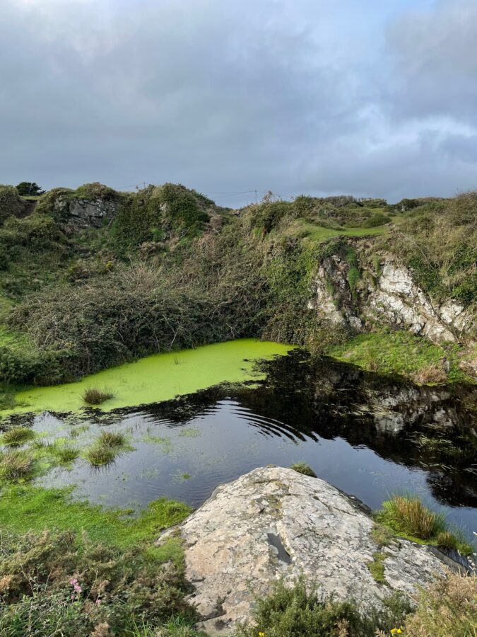
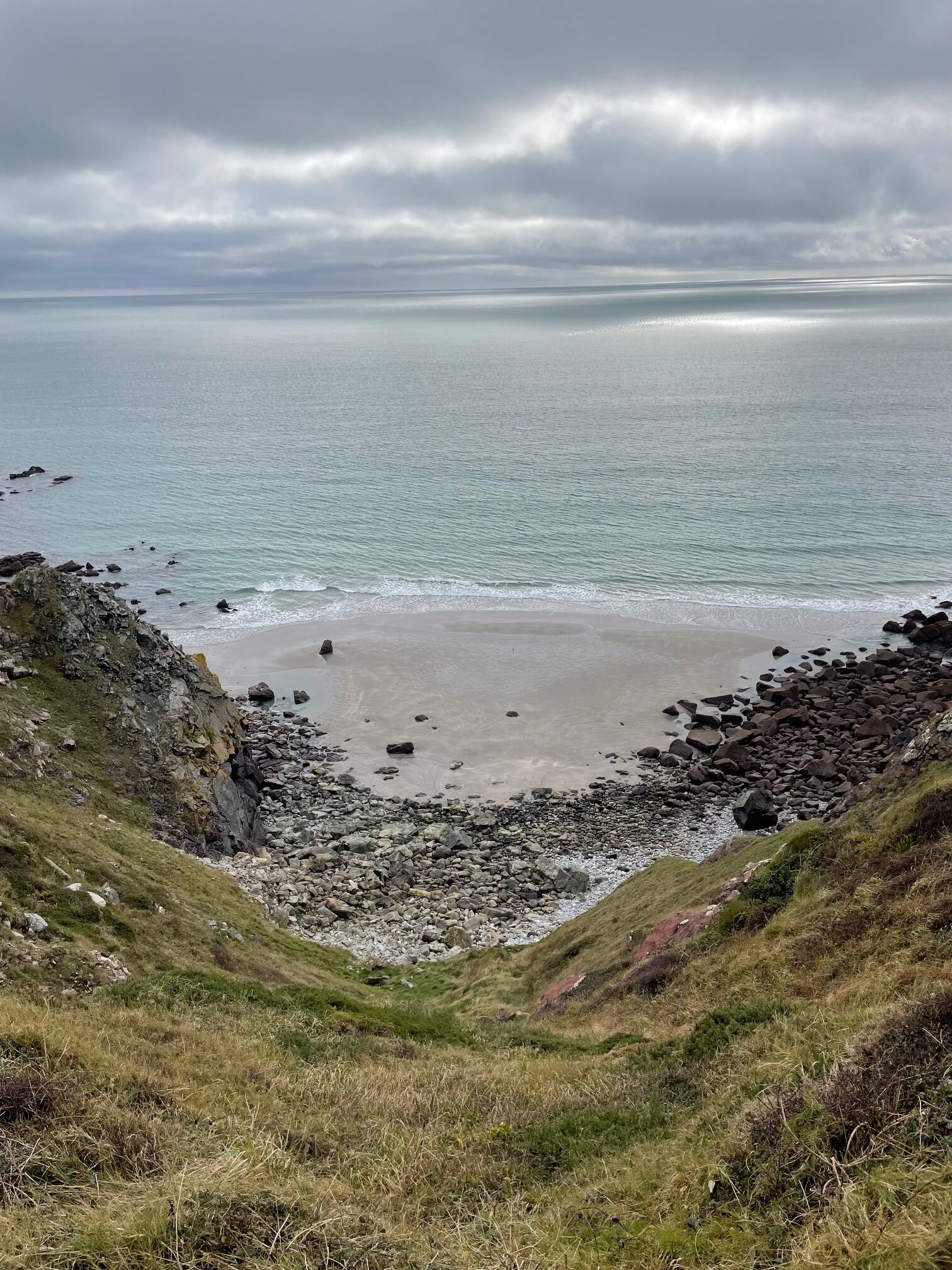
Caves are marked on the map, which we see no sign off, but we do find a very deep looking pond, the water dark and very still – until we throw a stone in!
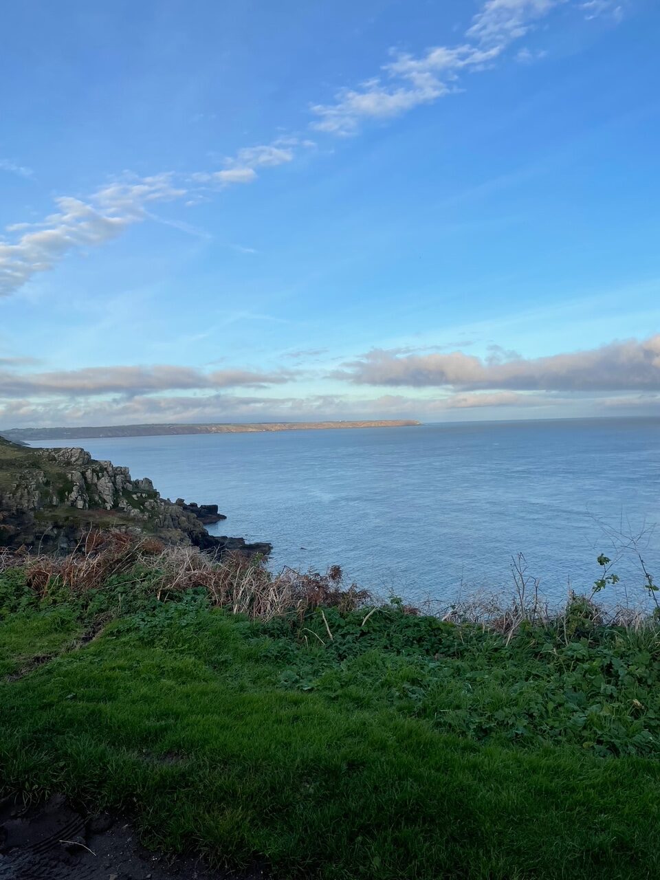
Looking ahead we can see the Lizard headland, and behind us the sun is shining on the clifftops that we’ve been walking these last few days. We weave round large rocky boulders and through narrow stiles, relieved the end is now in sight.
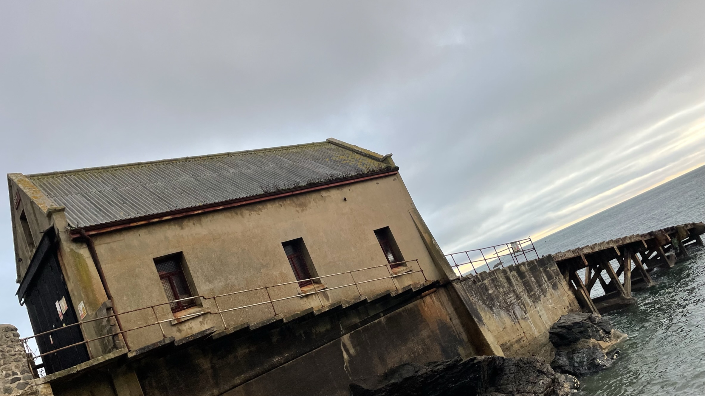
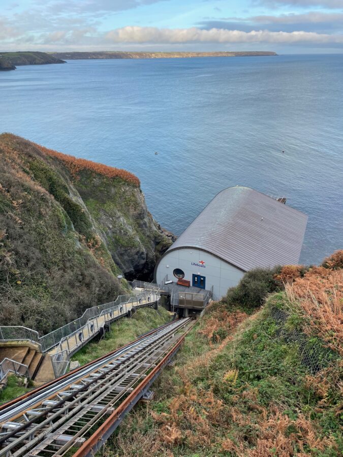
At Church Cove the road snakes away from the sea, houses dotted along. Then just round the corner at Kilcobben Cove we discover steep steps and a seemingly even steeper railway, leading down to the RNLI lifeboat station. Opened in 1961 it replaced the Lizard and Cadgwith lifeboat stations, allowing better access to the sea for larger vessels. Looking down towards the modern building with its curved roof I can make out a sign saying closed, good job we didn’t venture down.
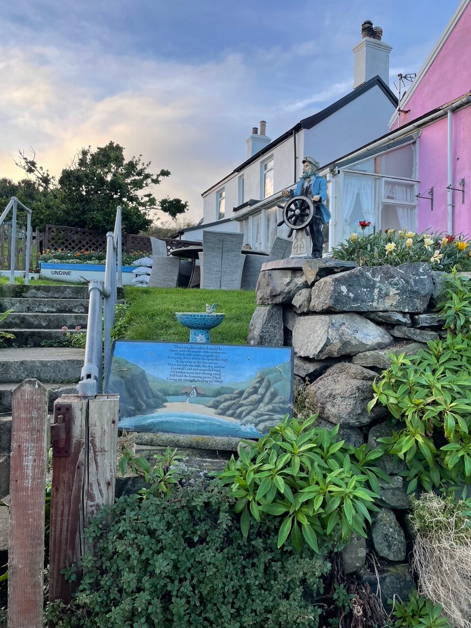
We dodge a rather cute pony on the path, more rocky boulders then past coastguard cottages – painted pink and adorned with poems, bird baths and a model sailor at the helm!
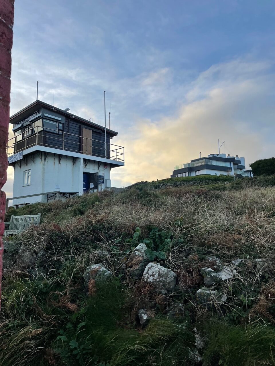
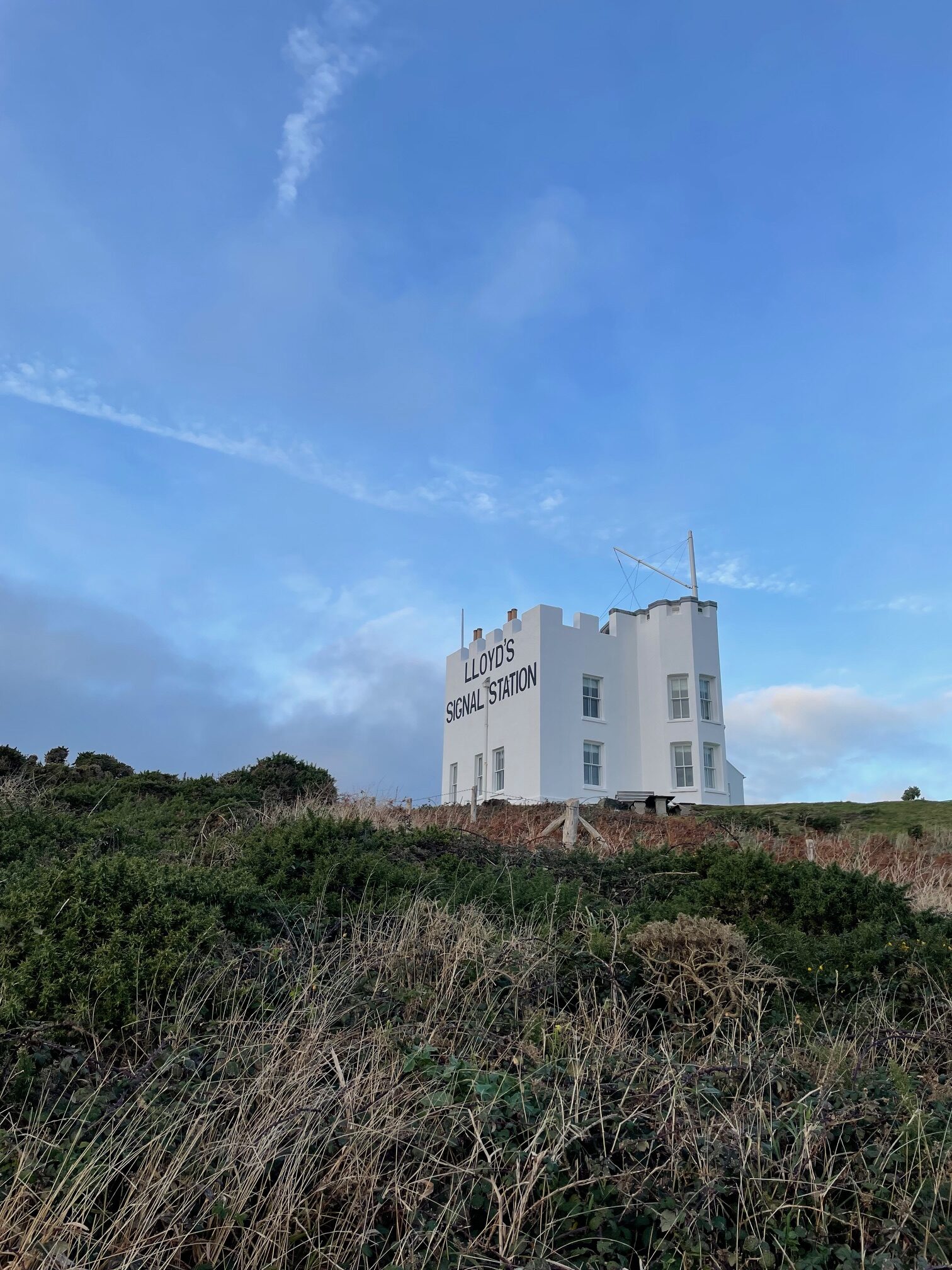
The beautifully preserved Lloyd’s Signal Station, with its castellated roof, large sashed windows and tall mast stands very proud above us at Bass Point. Built to provide communication between ship and shore from 1872 using flags, coloured lights, rockets and steam whistles! These messages were then conveyed to Falmouth by a horse rider. It’s now a very, very stylish coastal holiday home.
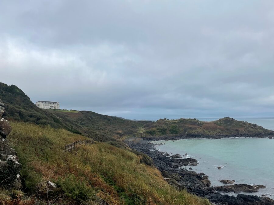
From here we continue into Housel Bay, where there’s a large hotel and on to the Lion’s Den, above which is an enormous group of buildings surrounding the Lizard Lighthouse. My what an impressive fog horn.
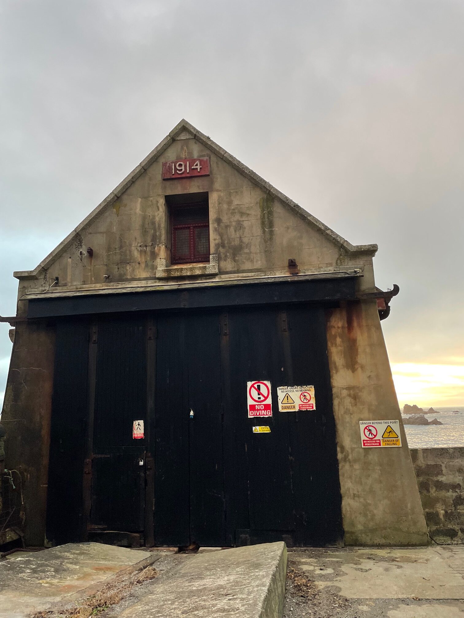
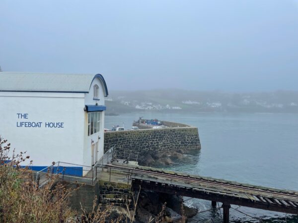
Then it’s a short hop around the corner to the old lifeboat house, quick snap of the camera then we follow the road out before the sun goes down. Arriving in the Lizard village we have 1/2 hour to wait for the taxi, it feels desolated and soul less, I guess it doesn’t help that it’s dark and drizzly and everything is closed up.
Leave A Comment